Posted by Madelyn Mateo

There are so many utilities and other right-of-way owners out there that are providing a commendable contribution to the environment and conservation, but the sustainability focus always seems to be on the “bigger” concerns, such as emissions or larger animals that people can relate to like a sweet manatee or a cute cougar cub. All of the good things that happen with right-of-way vegetation management remain unnoticed.
One of the top maintenance costs for utilities is the work that goes into maintaining vegetation, yet those practices that have a major contribution to sustainability are rarely captured. For example, the term integrated vegetation management (IVM), which utility vegetation managers have used for decades, is not commonly known or understood. This concept allows managers to plan work so that the utilities are protected from dangerous trees that may cause power outages. IVM also provides habitat for pollinators including bees. Yet, utilities and other right-of-way owners are slow to recognize the importance of using IVM data to communicate the benefits and positive outcomes with their colleagues, executive team, customers, agencies, and the public at large. One simply transformational way to capture and share these compelling vegetation management stories is by using Clearion and its partners such as ESRI, GeoMatch, GroundVu and others to collect, process, and interpret the data that can be turned into a story map that reveals the great contributions to safety, conservation, and pollinator habitat that our utilities are providing to all.
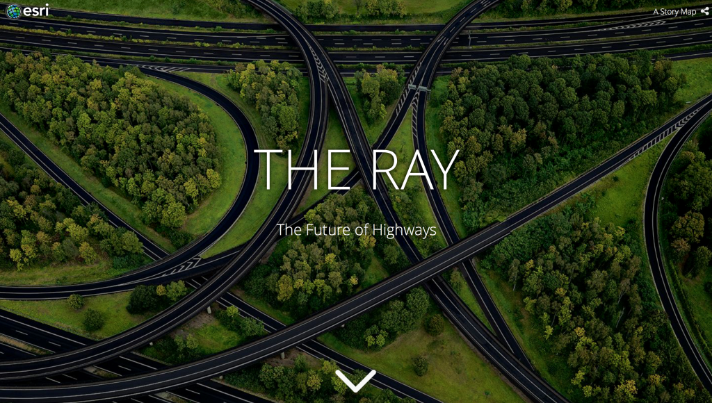
Here’s a quick peek at how Clearion and its partners are working together with right-of-way owners and non-profit organizations to unveil these conservation stories. The Ray is a non-profit organization in Georgia, named after the recognized environmental leader Ray C. Anderson, which is using innovative ideas and technologies to create a “regenerative highway ecosystem.” Part of this ecosystem involves creating pollinator habitat. The Ray has partnered with the Georgia Department of Transportation (GDOT), its vendor Wilderness Environmental Services (also referred to as “Wilderness”), and Clearion to turn this vision into a reality. The Ray is unique in that the organization does not own the environment that it is working to transform. The land is owned and operated by the GDOT, which has its own priorities and requirements for its vegetation management program. To sum it up, the GDOT wants to protect the road from vegetation disturbance, the vendor wants to ensure that its service adequately manages weeds on the GDOT right of way, and The Ray wants to ensure that the pollinator habitat is not damaged or mowed. Clearion recognized that these entities could be connected and become in sync to achieve their goals with the aid of some smart software. Yes, you guessed right, they implemented a Clearion solution. Wilderness planners currently use Clearion to identify work that needs to be done, then issues that work to the field workers who use Clearion to conduct the work. Clearion collects the data, and, once the work is completed, it is synced almost in real-time. The great thing about using Clearion is that the manager can add work locations to the map and mark restricted areas where work should not be performed. For example, if The Ray has communicated to GDOT not to spray in a specific area, they can create a polygon with a “no spray” flag that will appear on the Clearion map letting the planner in the field know NOT to spray in that specific location.
In a conversation with Anna Cullen, director of external relations and communications of The Ray, she explained that they are able to communicate the precise locations along the GDOT right of way that they do not want to be mowed or sprayed. The reason Cullen believes that this is important is because there are some plots where The Ray is growing perennial grasses or other pollinator plant plots that are not flowering and could possibly resemble a bunch of weeds. Before, a vegetation manager might mistake these plants as those needing to be cleared. Clearion provides a cue to the manager and applicator on-site that the specific location needs to be left alone. This symbiotic relationship between the utility, vendor, and non-profit did not appear with a snap of a finger. First, conversations between The Ray and GDOT led to a signed agreement allowing The Ray to conduct its projects. Then there were days of planning meetings with Wilderness to communicate the project and provide the locations to be identified in the Clearion maps.
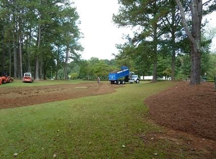
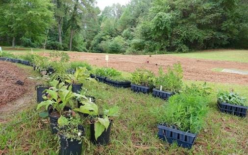
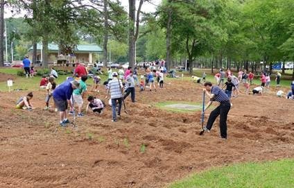
What does all of that work look like in action? The Ray recently conducted a service project in coordination with KIA to install a pollinator habitat plot at a rest stop. The following three images show you plot preparation (aka before scenes).
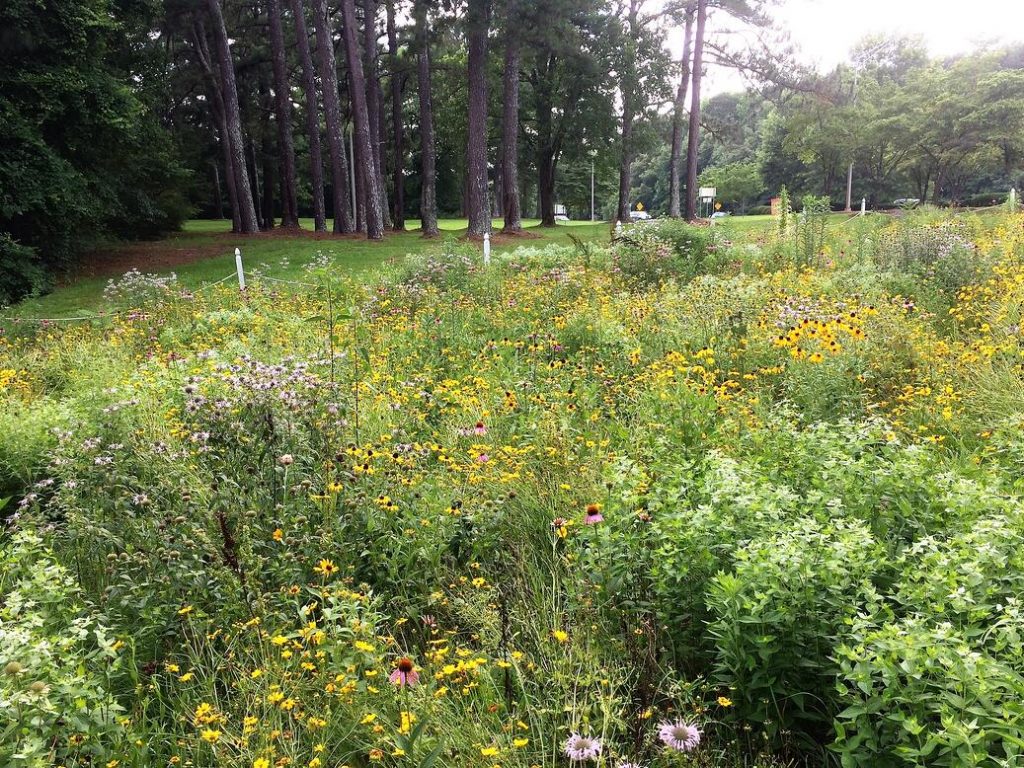
After just a few months of volunteers engaging in planting pollinator plants, the GDOT rest stop area is teaming with pollinators and is a success story for the GDOT, Wilderness, The Ray, KIA, and especially for the pollinators. Take a look at the growth and beauty of perennial grasses and other pollinators once filled in (aka the after scene!).
The Ray also completed a pollinator planting with a school at a location that had a steep slope and was used as a form of erosion control. The possibilities for utilities contributing to the creation of pollinator habitats are limitless!
As all these projects were in progress, Michelle Vignault, account executive at Clearion, recommended that Cullen create an ESRI-based story map in combination with the data collected with Clearion. Vignault understood that having all this data can feel overwhelming and that it is challenging to tell a story with so much information. Clearion chose to work together with The Ray to help create a story map about its conservation efforts.
Cullen learned from this that by using a GIS platform you can set yourself up to collect tons of information that can help illuminate and communicate your purpose and mission. She explained that infrastructure enterprises should take on the challenge of understanding their value to the greater good and leveraging the data that already exists. Though story maps are fairly new to the public, it is easy to see their power to harness complex information and promote your efforts in a visually compelling, attention-grabbing format that can be shared on websites, social media, and in executive boardrooms.
Please take some time to explore The Ray story map by scrolling through the interactive pages that take advantage of geospatial data. The Ray will be adding drone footage to its living, breathing educational story map soon, so stay tuned! If you wish to share your vision and your story through a story map, feel free to reach out to Clearion about how to get started. Thank you for Bee-ing and Buzzing around.