Trusted By Utilities & Infrastructure Companies Around The World
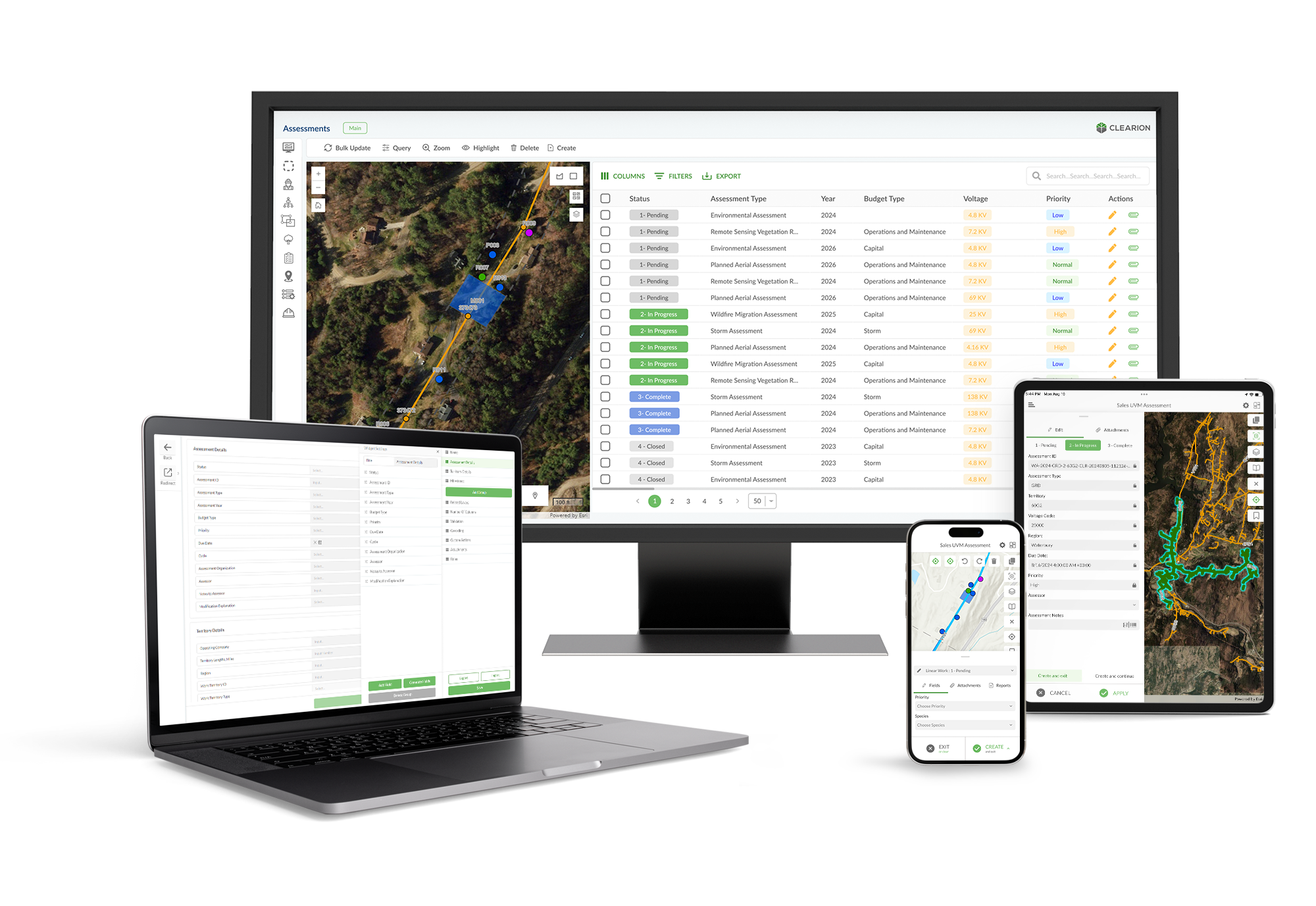
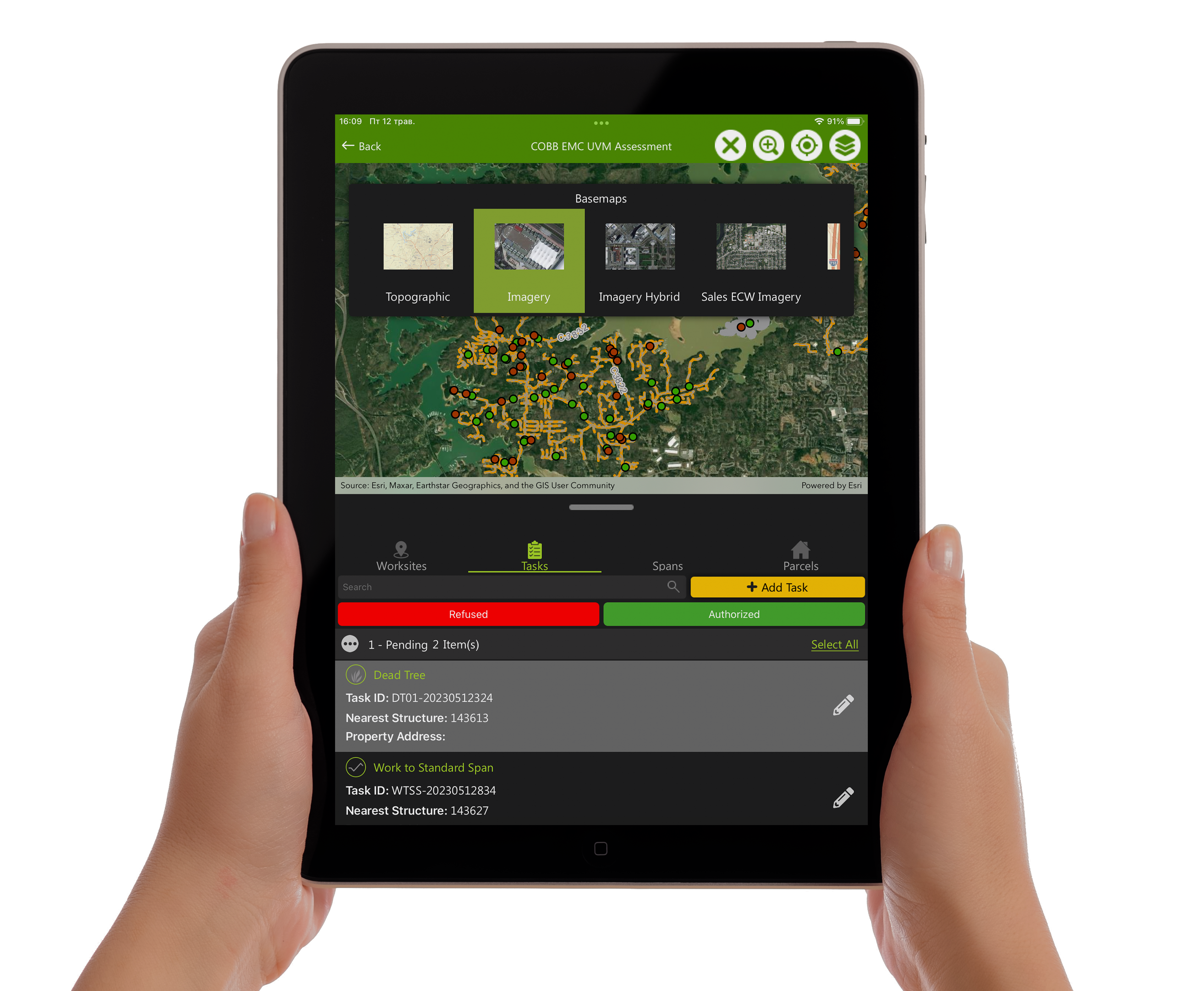
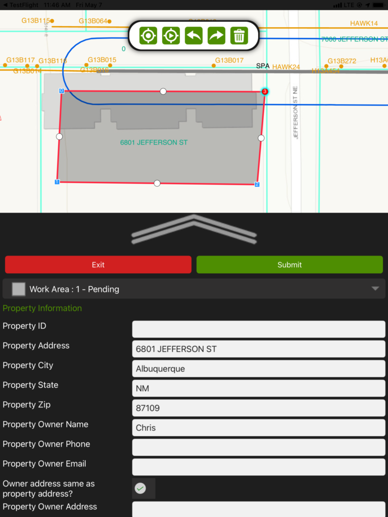
Everything works better with maps
From executives to field crews and out to stakeholders in the community, Clearion radically transforms your vegetation & infrastructure management workflows in innovative, practical, and powerful ways—powered by Esri ArcGIS maps
Visualize job sites using maps
Contextualize work with basemaps derived from satellite imagery, streets, topographic or hybrid views
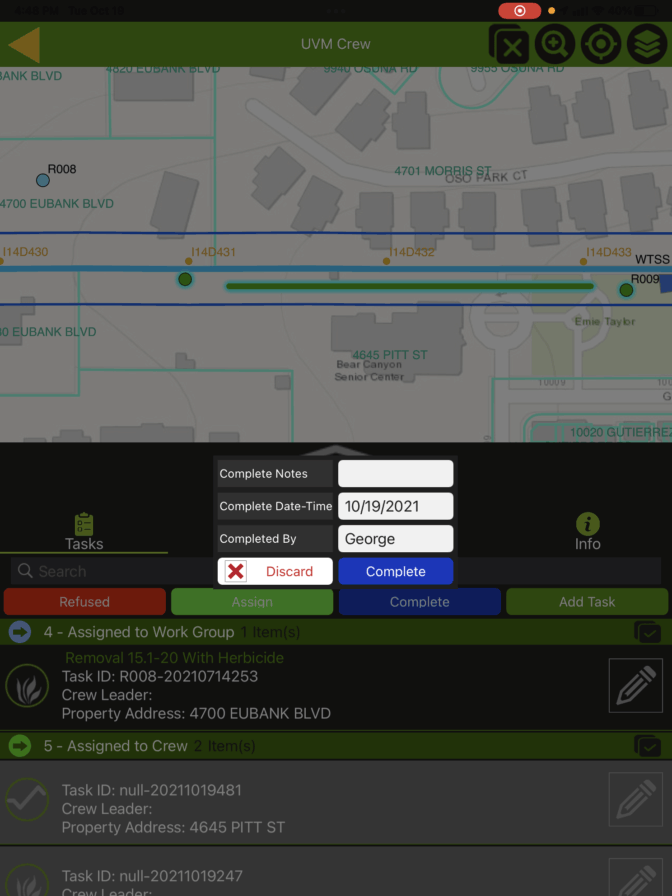
Capture complex information with fewer clicks
Sketch new tasks in maps with just a few clicks, and bulk update them later just as easily
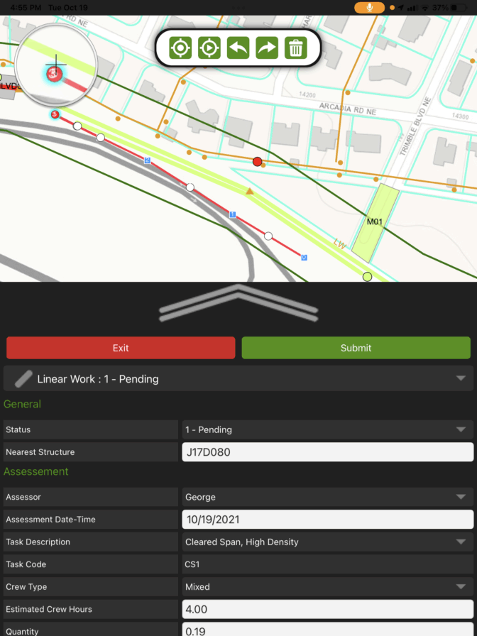
Measure precisely using maps
Use GPS to precisely measure the length and area of the work being planned so inspectors and assessors can accurately estimate costs, and better assign jobs out to their crews
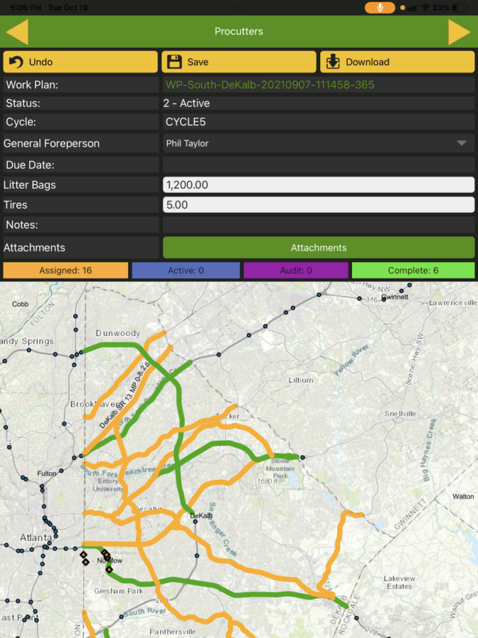
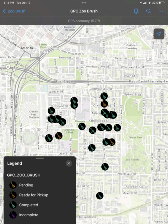
Track and report progress on maps
Record work status span by span, and create visual status reports to be shared with managers and clients alike
Engage with your local community
From ensuring compliance with local regulations to recycling waste byproducts, such as dropping off woodchips to non-profits in need, Clearion helps your company to be a better neighbor
Built on the world’s leading geospatial platform
Clearion’s solutions for vegetation and infrastructure management are built using the complete suite of ESRI apps, tools, and data
Testimonials
“They (the crew employees) had access to data that they’ve never had before and no longer needed the big stacks of map books. They saw that someone can update information in the system, and they would receive that information automatically within seconds. They were surprised how fast and easy data flowed within the software.”
Dan Siewert, Regional Forester
“Thanks to Clearion, we’re able to access real-time visibility right into our daily fieldwork right on our phones. It’s really quite transformative to just point and click on maps and have everything you need right there.”
Robert Brewer, CEO
“Clearion has helped our Vegetation Management Department stay operational with little interruption. We got Clearion just at the right time. Now that we have a paperless business process, I can easily work from home to dispatch crews through Clearion. The crews can receive the work, complete it then sync it back to me.”
Holley Goddard, Dispatcher
Ready to learn more?
Contact us to schedule a consultation focusing on your organization’s goals.
Contact Us
"*" indicates required fields
We use cookies on our website to give you the most relevant experience by remembering your preferences and repeat visits. By clicking “Accept”, you consent to the use of ALL the cookies.
This website uses cookies to improve your experience while you navigate through the website. Out of these, the cookies that are categorized as necessary are stored on your browser as they are essential for the working of basic functionalities of the website. We also use third-party cookies that help us analyze and understand how you use this website. These cookies will be stored in your browser only with your consent. You also have the option to opt-out of these cookies. But opting out of some of these cookies may affect your browsing experience.
Necessary cookies are absolutely essential for the website to function properly. These cookies ensure basic functionalities and security features of the website, anonymously.
Cookie
Duration
Description
cookielawinfo-checkbox-analytics
11 months
This cookie is set by GDPR Cookie Consent plugin. The cookie is used to store the user consent for the cookies in the category "Analytics".
cookielawinfo-checkbox-functional
11 months
The cookie is set by GDPR cookie consent to record the user consent for the cookies in the category "Functional".
cookielawinfo-checkbox-necessary
11 months
This cookie is set by GDPR Cookie Consent plugin. The cookies is used to store the user consent for the cookies in the category "Necessary".
cookielawinfo-checkbox-others
11 months
This cookie is set by GDPR Cookie Consent plugin. The cookie is used to store the user consent for the cookies in the category "Other.
cookielawinfo-checkbox-performance
11 months
This cookie is set by GDPR Cookie Consent plugin. The cookie is used to store the user consent for the cookies in the category "Performance".
viewed_cookie_policy
11 months
The cookie is set by the GDPR Cookie Consent plugin and is used to store whether or not user has consented to the use of cookies. It does not store any personal data.
Functional cookies help to perform certain functionalities like sharing the content of the website on social media platforms, collect feedbacks, and other third-party features.
Performance cookies are used to understand and analyze the key performance indexes of the website which helps in delivering a better user experience for the visitors.
Analytical cookies are used to understand how visitors interact with the website. These cookies help provide information on metrics the number of visitors, bounce rate, traffic source, etc.
Advertisement cookies are used to provide visitors with relevant ads and marketing campaigns. These cookies track visitors across websites and collect information to provide customized ads.