Posted by Nathan Beningson
LiDAR Digital Elevation Models (DEMs) offer an unprecedented view of the the landscape. A plane with a laser array coats the landscape with millions of laser shots, with each one returning a point of elevation. While there are many applications for this emerging technology, especially for utilities, my background as a geologist has led me to research how LiDAR can be used to model surface hydrology and developing the DamDestroyer toolbox in ArcGIS. DamDestroyer began as an undergraduate research project, which I presented at the ESRI 2019 Southwest User Conference.
TRACKING WATER FLOW
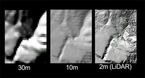
With each pixel representing a 1×1 meter—or less!—square on the ground, features instantly become recognizable: every little hill, river, drainage ditch, and roadway stands out in ways not seen in traditional satellite imagery. By using LiDAR digital elevation models to track where water is flowing, scientists can study more detailed questions examining river erosion, flood events, or agricultural runoff.
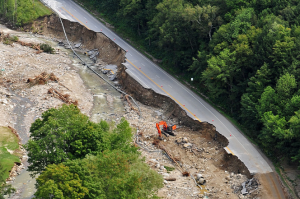
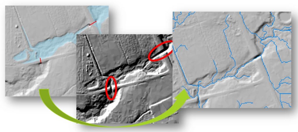
Modeling hydrology by using LiDAR runs into issues where roadways cross rivers. LiDAR only maps the surface, so that elevated bridges stick out like artificial dams on the landscape. The tools calculating where rivers flow cannot tell where culverts are specifically located.
This can dramatically reroute calculated stream pathways sideways, in straight lines, or even uphill, resulting in inaccurate stream networks. Old hydrology tools are no use, as they are made for data with much coarser resolutions.
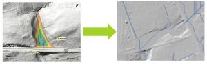
DamDestroyer intelligently removes these artificial dams from LiDAR DEM’s, enabling flow modeling on the scale from single agricultural fields up to entire watersheds. DamDestroyer is an ArcGIS toolbox using spatial analysis designed for the average user.
IN FOUR STEPS
The tools identify areas artificially dammed by roadways, find paths to breach the dams, burn these paths into the DEM, and calculate a new flow network. LiDAR hydrology made by DamDestroyer has been used in studies looking at agricultural runoff contaminating Lake Champlain, and river erosion from extreme flooding events due to climate change.
HOW WE CAN HELP
Clearion offers a complete approach for data—big and small. We know that big data is important, but your software must do much more. With Clearion, you can take control of your business data—from LiDAR to reporting and analytics to customer care and environmental compliance—in a single integrated system. We offer flexible tools, hands-on deployment, and robust reporting for everything you do.
![]()